What’s New in gINT
Civil Tools Professional Plus Update 7
Consider Interpretation
Points when creating Terrain
New option to consider
Interpretation point: Use all Boreholes and Interpretation Points – When
checked, automatically selects all loaded boreholes and interpretation points
(if any) to create the terrain.
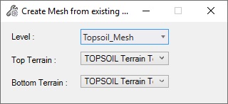
Create Mesh from Existing
Terrain: Creates a Mesh from a top and a bottom terrain, within a defined
boundary.
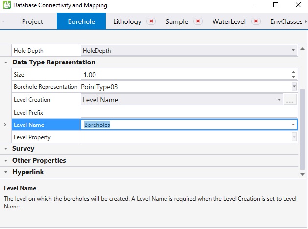
New option to specify which
level to be used for borehole creation: It is now possible to select an
existing level on which borehole elements will be created.
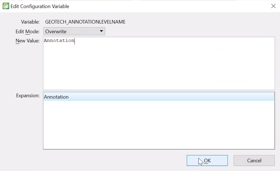
Allow Borehole Annotation
to be created on a different level than the borehole: By default, annotations
are placed on the Borehole Text level (this level will be automatically created
if it doesn’t exist). It is possible to specify another level name by using the
following configuration variable: GEOTECH_ANNOTATIONLEVELNAME
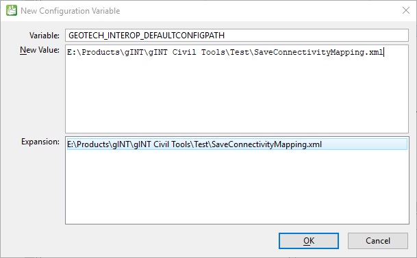
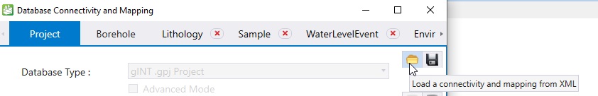
New configuration variable
to specify the default setting files to be used (xml storing the mapping):
GEOTECH_INTEROP_DEFAULTCONFIGPATH
Once set up, using the "Load
a connectivity and mapping from XML" tool will automatically points to this xml
file: